- First: Test on Chapters 1 - 4: MakingMaps
- Second: Playing with projections - see below.
- Open ArcMap
- Add the WorldMap data from the C:\ drive ==> C:\ArcGIS\Data_Maps\Data & Maps\world\World Map.lyr
- Explore the coordinate system of the layer and the data frame. HowTo? Right-click the data frame and then look at the Coordinate System tab.
- What is the coordinate system of the data and data frame?
- How did the data frame get this coordinate system?
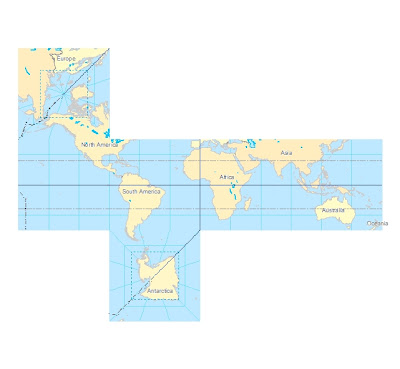
- Explore some other coordinate systems by changing the coordinate system of the data frame. HowTo? Under the Coordinate System tab of the Data Frame Properties ==> Predefined - explore some Geographic Coordinate Systems first (for the entire world) and some Projected Coordinate Systems second (for the entire world).
- Export the Projected Coordinate System you like the most to an image and upload it to your blog - along with the answer to the questions from 4 and 5 above.
- Save your map document to your flash drive!!
Below is a projection I like called 'Vertical Perspective'.

No comments:
Post a Comment